Feeds:
Posts
Comments

Posts Tagged ‘phone’

I spent the past few days at the mHealth Summit where James BonTempo and I (supported by Plan International USA and MCHIP via USAID) co-hosted the “mHealth Reality Booth,” which we hoped would bring some mHealth practitioner reality to the Summit and offer an opportunity to capture some learning from folks working on the ground and implementing mHealth programs in some of the less cushy environments.

As people came by the booth, we asked them if they’d be willing to do a short video that completed the idea:

“We thought that…. but in reality….” or “Most people think…. but in reality….”

We ended up with some great advice on mHealth design and implementation. Watch below or on YouTube! If you have an mHealth Reality you want to add in the comments or as a ‘video response’ please do!

Here’s our talk-show host intro (why does self-filming always make me look so weird?) and our list of mHealth Realities underneath. Enjoy!

1) Phones do get stolen, so you should involve health workers in determining what the consequences are when it happens.

2) When hospitals are gutted, cell towers are gone and there’s no electricity, for example during the Great Floods in Pakistan, you have to go back to the basics.

3) The technology should be the last thing to think about in the design process. You need to know the what first, and then think about the how.

4) Mobile operators are very interested in exclusivity. This is a challenge if you want your project to reach the entire population.

5) Even if your macro level research tells you that 80% of households have mobile phone access, it doesn’t mean that 80% of women have mobile phone access.

6) There’s literacy, and then there’s ‘mobile phone literacy’. Both are important.

7) If your paper form is crap, your mobile data collection form will also be crap.

8 ) You need policies on lost, damaged, stolen phones, and emergency mobile phone resuscitation training.

9) You will be beholden to traditional funding cycles regardless of how innovative you are, or how sustainable your own business plan is.

10) NGOs just want to come in and do one year pilots, pack up and leave, and come back to do another one year pilot. This is not sustainable. Governments need to be involved. (in French translation pending…)

11) You really need someone who’s available locally to provide technology support and someone who’s good at helping others use and be comfortable with tech.

12) Power is always a consideration. Having it figured out in one place doesn’t mean you have it solved for another place.

13) Things take a really long time. Much longer than you initially think.

14) You might love designing for iPhones and Androids, but if your users don’t have iPhones and Androids, well, that’s not very useful, is it?

15) There are very talented software development firms in places outside of the US and Europe.

16) Every assumption you have about an area or a population is probably wrong.

17) Every country has a different set of mHealth issues and there’s no way of anticipating until you have hands on the ground there.

18) User testing will help you understand what users really want. And NGOs need to ask themselves the hard question: why do we really want to use new technologies?

19) People in low resource settings and with no previous experience really can learn to use smart phones and like it.

Watch all 20 on YouTube.

Read Full Post »

Because I am a Girl 2010

The urban and digital environments are the 21st century’s fastest-growing spheres. Both offer enormous potential for girls around the world, but prejudice and poverty exclude millions of girls from taking advantages of the transformative possibilities that cities and information and communication technologies (ICTs) can offer.  Exploitation and the threat of violence exist in both urban spaces and in cyberspace, especially for the most marginalized and vulnerable girls.

Since 2007, Plan has published annual reports on the state of the world’s girls. The 2010 ‘Because I am a Girl report’ is called Digital and Urban Frontiers: Girls in a Changing Landscape. It focuses on girls in these two rapidly expanding spaces: the urban and the digital.

The piece that I’m most interested is the segment on Girls and ICTs, since that’s the main area I currently work on. (Disclosure: I contributed to the development of the chapter). To give you a taste of what’s in the report, here’s a summary of Chapter 4: Adolescent girls and communications technologies – opportunity or exploitation. You can download the full report here.

Chapter 4’s introduction explains that online behaviors mimic offline behaviors.  Empowerment and abuse of girls reveals itself through technology as it does in other areas of girls’ lives.  Through girls own voices, expert opinion and original research, the report highlights the positive and negative consequences of ICTs, in particular mobile phones and the Internet. The authors talk about the positive ideas and new ways of thinking that ICTs open up for girls in terms of learning, networking, campaigning and personal development. They then discuss the darker side of technology  — how cyberspace makes it easier for sexual predators to operate with impunity, where girls are prime targets for abuse, and where girls are sometimes perpetrators themselves.

Section Two offers girl-related statistics on the digital revolution and the digital divide and highlights the enormous variation between and within countries in terms of digital access, and the gaps between rich and poor, male and female, urban and rural.  The report cautions that excluding girls from the digital revolution will have consequences on their growth and development. For additional global ICT statistics (1998-2009) see this post at ICT4D blog. Another resource on mobiles and women is the Cherie Blair study.

Section Three describes and provides statistics around 7 important reasons that ICTs are important to adolescent girls:

  1. To keep in touch with others and reduce isolation in countries where this is an issue
  2. To further their education and acquire new skills
  3. To take an active part in their communities and countries
  4. In order to have the skills to find work
  5. To build specific skills and knowledge on subjects they might otherwise not know about, such as HIV and AIDS
  6. Because evidence has shown that learning to use these technologies can build self-esteem
  7. In order to keep safe

Section Four goes in depth around ways that adolescent girls compete with adolescent boys for the most use of communications technologies such as mobiles and the Internet, but that often they are using them for different reasons and different purposes. Most of the available research for this chapter is from the ‘North’, yet the studies indicate that girls tend to use ICTs for communication and boys tend toward a focus on the technology itself. Studies on this from the ‘South’ are unavailable to date.

When girls are treated as real partners....

Section Five discusses the barriers that keep adolescent girls from accessing ICTs. In other words, if the importance of ICTs has been established, girls are willing and able and keen to use ICTs, then what prevents them from having equal access to ICTs? Some of the issues that the chapter discusses are those of power and control.

‘I can immediately call the wholesale market to inquire about prices and place direct orders. I am now recognized as a businesswoman, growing and selling sesame seeds, not just as somebody’s wife or sister,’ said a woman in India.

‘You’re a girl – a mobile can cause many problems, and so you don’t need it,’ said the father of a Palestinian girl.

Girls’ access to technology is limited by their societies, communities and families. In patriarchal societies where men control technology, girls and women simply have less access, because ICT’s confer power on the user. Even in educational settings, a study found that boys tend to hog available ICTs. Teachers have distinct expectations from boys vs. girls. Girls also don’t tend to go into the field of ICTs or want to have ICT careers, since the field is typically a male field. ‘Technology appears to be marketed by men for men. It’s time we started switching bright and talented girls on to science and technology,’ comments a British government official.

Women and girls in developing countries however are not receiving the basic education and training that they need to be ready technology adopters. They are seen as users and receivers of technology, not as innovators involved in technology design and development. Once they are computer literate, however, many young women see the computer industry as a route to independence. The report offers statistics on the numbers of young women in countries like South Africa, India, Malaysia and Brazil who are working in the ICT related industries and professions.

What stops girls from using technology?

There are seven key factors that prevent girls from taking advantage of technology:

  1. Discrimination – girls are still viewed as second-class citizens in many societies.
  2. Numbers – boys both outnumber girls and tend to dominate access to computers.
  3. Confidence – because they don’t have equal access at school, girls may be less confident than boys when it comes to going into IT jobs because they don’t feel they have the same skills and knowledge as the young men competing for the jobs.
  4. Language – in order to use these technologies, English is usually a requirement, and for girls with only basic literacy in their own language, this is a major barrier.
  5. Time – girls’ domestic roles, even at a young age, mean they have less free time than boys to explore and experiment with new technologies.
  6. Money – girls are less likely than their brothers to have the financial resources to pay for, say, a mobile phone and its running costs, or access to the web in an internet café.
  7. Freedom – boys are also more likely to be allowed to use internet cafés because parents are concerned about their daughters going out on their own.

Section Six digs into the dark side of cyberspace and the risks that adolescent are exposed to at a time of their lives when they are beginning to develop sexually. One in 5 women report having been sexually abused before the age of 15, according to the authors. The Internet by and large is simply a new medium for old kinds of bad behavior, however; and new technologies simply extend the possibility of abuse to new arenas. Girls who are not even using the Internet are still vulnerable, given that a photo of them can be taken and posted by someone else even if they have no computer access. Cyberbullying and cyberharrassment are other risks that girls face.

Many young people and youth organizations are active in facing these risks and protecting themselves, and various campaigns exist to help adolescent girls be more aware of how to protect themselves while using ICTs. New technology can itself also be a tool to help with counter-trafficking efforts. The chapter outlines some of the different efforts being made to protect girls online, and emphasizes the role of parents and schools in discussing on-line use and being supportive as girls begin exploring cyberspace.

There is a quite broad set of recommendations for a wide array of actors at the end of Chapter 4 that could be taken up, contextualized and fleshed out by different parties or stakeholders into specific calls to action:

Brazilian girls in a digital world. As an annex to Chapter 4 on ICTs, new research with 49 boys and 44 girls, aged 10-14 examines adolescent girls’ rights and protection in Brazil within the context of ICTs. ICT use is growing exponentially in Brazil, particularly among 15-17 year olds, where between 2005 and 2008, ICT usage went from 33.7 to 62.9 percent. The study covers use pattern, links between on-line and off-line behavior, and on-line safety.

Conclusions. The report concludes by calling for greater knowledge about ICT-related sexual exploitation and violence against girls, more emphasis on prevention and stronger international standards. It also points out that girls need to be empowered to use new communications technologies safely, on their own terms, and in ways that promote their development and build their futures.

Call to action for September 22: As part of the launch of the Because I am a Girl Report, Plan is calling for International Day of the Girl to be established on September 22. You can sign the petition here.

Resources

Download the full report here: Digital and Urban Frontiers: Girls in a Changing Landscape

Download the Girl’s Cohort Study: Real Choices, Real Lives. Plan researchers follow 142 girls lives over a 9-year period.

Download past Because I am a Girl Reports (since 2007)

Related posts on Wait… What?

On girls and ICTs

Revisiting the topic of girls and ICTS: Tech Salon Discussions

Being a girl in Cumbana

MDGs through a child rights lens

3 ways to integrate ICTs into development work

5 ways ICTs can support the MDGs


Read Full Post »

Yesterday my colleague Mika Valitalo at Plan Finland sent some information about mGeos, a cool project that Pajat Management (a Finnish company), Plan Kenya, Plan Finland, Helsinki University of Technology and University of Nairobi have been collaborating on for the past year. Note: Mika and Pertti Lounamaa from Pajat gave me written permission to share this info.

The idea? To develop easy-to-use GPS-based mapping software that runs on low-cost mobile phones.

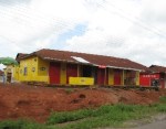
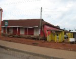
Detailed map information is missing from most of the 'developing' world

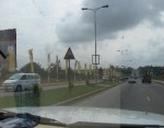
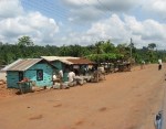
What needs is mGeos responding to? Being efficiently able to provide health, education and humanitarian aid or even most industrial services is critically dependent on knowing where to provide these services. Basic location information about points-of-interest (POIs), routes to them and areas to service are missing from the countries in most need of public service improvement. In ‘developing’ countries especially, critical map and location information is largely incomplete, outdated or missing. For example, in the image here, you can see small town map details available for Finland (left image) vs for those for Kenya (right image).

Earlier experiences in a few program countries as well as responses to a questionnaire conducted with Plan Kenya staff showed a desire and clear need to use location data more effectively. There is also a need to make it available on low-cost phones that are more accessible.

Stefanie Conrad (my awesome boss) for example, sees it like this:

“Geographic analysis of the distribution of social services such as wells, hospitals, telecommunication facilities, broadcast services, schools, etc. is essential for Plan’s program work in order to have a sound understanding of the best way to provide access to those services. In reality, most of our country offices work with non-geographical systems, for example, lists of communities. In many countries, the government itself does not have sufficient mapping of communities in place. Decisions on where to put something to guarantee access to populations often becomes a thing based on best guess.

Mobile phones with GPS could support more equitable and technically sound placement of basic services. Digital pictures and maps could be used with communities in order to facilitate discussions about where to best place a well, for example. This can often be a difficult process, as usually community leaders try to get these types of services to be conveniently placed as close as possible to their own homes….  Many of our offices also have difficulties producing the maps needed for corporate communications (area overviews, local area maps, etc) – this would become possible with GPS.”

The mGeos project aims to respond to these identified needs. A 3-month field pilot is planned to take place in Kilifi, Kenya, in July.  I’ll be in Kenya in July and if the pilot goes forward then, I am hoping to be able to see personally how mGeos works!

What are mGeos’ key features?

  • mGeos service platform

    Supports collection of structured data as numbers, text, exclusive and multiple choice and images; and also location data including points of interest, routes and areas

  • Multiple front ends:  standard internet browsing for laptops and large screen smart phones and mobile browsing (xHTML/WAP)
  • Dedicated application for GPS enabled mobile phones
  • Authoring tool for defining forms and corresponding database model for storing the collected data
  • Open API for accessing stored data
  • Based on a SaaS (software as services) model

What does the mGeos system consist of?

  • client software which runs on low-cost S40 GPS enabled mobile phones (eg. Nokia 2710)
  • server running a database where all the collected information is stored and accessed
  • portal i.e. webpages which show the collected Points of Interest (POIs) on Google maps (or other maps) and allow browsing, exporting and sorting of the collected data.

What would mGeos look like in action?

Say a field worker named Victoria arrives to the Kilifi District Program Unit in the morning. She’s planning to visit Kujemudo community. Before leaving for the day trip, she takes a GPS enabled mobile phone from the office and downloads the latest updated ‘Points of Interest’ (POI) list from the computer to her phone.  The POI list has been created by Victoria and her colleagues by gathering location data while visiting different communities during the past couple of months.  Today Victoria also wants to map important POIs in the communities, among many other tasks.

After arriving to Kujemudu and having a meeting with the local community based organization, Victoria rides her motorbike over to a school building in Ezamoyo village, takes her GPS enabled mobile phone in hand, and starts the mapping application.  The she chooses ‘add POI’ from the menu, selects the POI category of ‘school’ and adds the name of the school. After that she also types in the additional information such as the number of pupils and teachers, ownership of the school, etc.  Finally she takes a photo of the school, attaches it to this record and saves the information to the phone memory to be transferred later to the computer server.

Next Victoria visits Mkombe village where the location and information of the school has already been entered into the database by her colleague Peter a few weeks earlier.  Victoria uses the POI browsing feature to find the right school (browse by POI category).  When she finds the existing data record, she chooses ‘edit’ in order to update the information. Because part of the school has been reconstructed, she takes a new photo of the school and replaces the outdated one. Also, since the number of students has increased, she edits the ‘school population’ field to match the current number. Finally she saves the record.

While visiting Mabirikani village the next day, Victoria checks one of the wells, because she has heard that it has collapsed due to recent floods.  Since this is clearly the case, Victoria takes the mobile, searches the well from the data base and marks the record as deleted.

mGeos web screen shot

The next day, Victoria arrives to the Kilifi District Program Unit, connects the phone to her computer, and uploads all the new records and changes. Then she sends them to the mGeos webpage, which gets updated (i.e., now all the users can see the Ezamoyo school building, the updated information from Mkombe, and will notice that the well in Mabrikani is no longer in use).

When Victoria sees the new information in the system, she notices that she has mistyped the number of pupils in Mkombe school.  Since she is the author of the information, she can also edit the record in the mGeos webpage to correct the information. After checking that all the other information is OK, she leaves the phone in the office and continues with other work tasks.

When will it be tested? We plan to fully test the application in Kenya in July. Plan Kenya/Kilifi District Program Unit has identified a number of  POIs ( schools, health facilities, water points, trading centers etc.) they would like to map. They have also listed additional information each POI should have. For example, for schools they would collect information on: name, type (special, integrated, non-integrated), level (primary, secondary…), numbers of pupils, availability of water and sanitation services, etc. etc.  This information would be entered into mobile phones running mGeos software and later transferred to the server for sharing, analysis, editing, reporting and exporting.

Once the pilot has run, and user input is collected, the system will be adjusted and improved so that it can be fully launched.  I’ll keep following the mGeos story and post more as it’s tested and rolled out!

Update:  For more information see these later posts:

mGESA: Mobile GEographical Services for Africa

Mobile Date Collection through Points of Interest in Kenya (on Mobile Active)

The final application is called PoiMapper (see www.pajatman.com). Give it a try by downloading it and installing it on your mobile!

Read Full Post »

On the road up to Wa (Upper West Region of Ghana) last week, I noticed something. I tried to capture it on the way back to Accra, yesterday. I snapped the shots from a moving vehicle, so they are not great quality. I posted several, because the remarkable thing for me was their sheer quantity.  (I am only posting about half the shots, and I was asleep for about 4 of the 10 hour drive). See for yourself. As far as I could tell these are not mobile phone company offices or kiosks, but houses and buildings used for advertising. Reminds me of political graffiti or turf wars you see between gangs.  [Note – if you have similar shots, please add a link in the comments!]

Read Full Post »